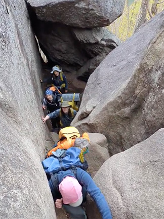
Join the New York Ramblers hiking club and discover some of the most delightful hiking trails in the greater New York City area. Our weekly hikes (listed down below) are usually:
- Sundays (or Saturdays)
- about 14-18 miles in 7-8 hours
- accessible by public transportation
- within 50 miles of NYC
For additional details, go to our About page.
For Serious Hikers
You MUST be an experienced hiker in good physical shape, with proper gear, and able to hike at a moderate to fast pace for 7-8 hours. Haven’t hiked with us before? No worries–come along as a guest and see what it’s like.
- Find a hike below
- Contact the hike leader
• tell leader about your hiking experience
• ask about how difficult the hike is
• find out when and where to meet - Meet us at the designated place
NYC subways are not as frequent on early Sunday mornings—allow extra time to get to the meeting place.
Hikes are free (thank you volunteer hike leaders!) After coming along on two hikes, send in the application form for membership. (Annual dues are $6 per year, plus $1 initial fee.) Some leaders may limit the number of guests on their hike.
Sorry, but our hikes are not for everyone. We hike at a moderate to fast pace. We hike all day long, often on rugged terrain. We have a lot of experience. If this isn’t you, please consider one of these groups that offer shorter distances and easier hikes:
- Shorewalkers
- Shorewalkers Meetup
- Appalachian Mountain Club
- Outdoors Club
- Westchester Trails Association
- NY-NJ Trail Conference
- Meetup
Follow the New York Ramblers on Facebook.
* * *
Hiking involves certain inherent risks; hikers participating do so at their own risk.
When you participate in activities listed in the Schedule, you should be both physically and mentally prepared and equipped with the appropriate gear. The hike leader is not responsible for your safety, you are. There is no age limit; however, those who bring children must assume full responsibility for their safety and conduct at all times. The hike leader has the authority to turn away anyone who is not adequately prepared. Hikes don’t always finish at the expected time.
* * *
>> Hike Calendar
CANCELLED. Due to the extreme heat forecast (> 100 deg F) this hike is canceled.
(East Hudson Highlands)
(Note: this is a Friday hike.) Tour Storm King Art Center on foot to see its amazing outdoor sculptures, vast green fields, and woods. Free admission. Note: since admission is free this day, purchase transportation only. Shizuko will meet group at Port Authority and Jim at Storm King Arts Center.
• Duration about 4 hours at a moderate pace
Leaders: Jim, Shizuko
THREE NJ PARKS: RIFLE CAMP PARK, GARRET MOUNTAIN RESERVATION, AND GREAT FALLS NATIONAL PARK.
(New Jersey)
Moderate pace. From the 191 NJTransit bus stop, use local streets to enter Rifle Camp Park and hike trails within. Use short connecting route to Garret Mountain Reservation to hike various trails and visit historical sites. Exit, and via local streets, enter and enjoy the Paterson Great Falls National Historical Park. Return to George Washington Bridge via the Paterson Jitney.
• Duration about 7-8 hours at a moderate pace
• Bring 2+ liters of water
Accessible by bus–contact leader for details.
Leader: Kay

FIRE ISLAND PINES.
(Long Island)
Take the LIRR from GCT to Sayville Station. Walk 30 minutes to the Sayville ferry terminal. Board the ferry to Fire Island Pines. Explore the boardwalks, hike the Fire Island National Seashore, and go for a swim. Return via Sayville Ferries and LIRR. Bring cash (cheaper for ferry).
• MEMBERS: See email sent July 8 for GCT meeting point – clarification.
• Duration about 7-8 hours at a brisk pace
• Bring 2-3 liters of water
Accessible by train and ferry–contact leader for details.
Leaders: bluegreenmer@gmail.com; Sara

GARRISON CIRCULAR.
(East Hudson Highlands)
14.5mi, 2600ft. From Garrison station use Blue and Red Glenclyffe trails, cross Rte. 9D, and hike up Sugarloaf Trail; then follow Osborn Loop (west side), Appalachian Trail (northbound), and Carriage Connector. (Digress to White Rock.) Use woods road to and past Lake Lucretia, to cross Rte. 403 and enter the Garrison School Forest trails. Hike trails within counter-clockwise, to the South Redoubt. Follow Red connector to North Redoubt. Exit to Garrison station via Snake Hill and Rte. 9D. NY-NJTC map 101.
• Duration about 7-8 hours at a fast pace
• Bring 2-3 liters of water
Accessible by train–contact leader for details.
Leader: Cameron

FOUR BIRDS TRAIL.
(New Jersey)
From Rte 23 Park & Ride at Kanouse Rd, access Four Birds trailhead at Bigelow Rd. Stay on Four Birds all the way to Splitrock Reservoir, traversing Green Pond Mtn, Copperas Mtn, and Riley’s Rise. Turn left to hike entire Beech trail. Turn left onto Splitrock, passing Indian Cliffs. Turn right onto woods road past Misty Pond and Charlotteburg Reservoir. Exit to return bus at Echo Lake Rd. NY-NJTC map 125.
• Duration about 7-8 hours at a fast pace
• Bring 2-3 liters of water
Accessible by bus–contact leader for details.
Leader: Leah

>> August
SOUTH HARRIMAN ROLLING HILLS AND PINE MEADOW LAKE LOOP.
(Harriman State Park)
From Sloatsburg Train Station, use local roads to Pine Meadow Trail which hike to Seven Hills trail. Leave SH for Hillburn-Torne-Sebago eastbound to Racoon Brook Hills which hike to Kakiat trail eastbound. Leave Kakiat for Suffern Bear Mountain eastbound. After passing Stone Memorial Shelter, turn north on Pine Meadow Road which hike to Pine Meadow trail westbound. After passing Pine Meadow Lake, join Kakiat westbound to Stony Brook trail to Pine Meadow trail to local streets and back to Sloatsburg Train Station.
• Duration about 7-8 hours at a brisk pace
• Bring 2-3 liters of water
Accessible by bus–contact leader for details.
Leader: Peter

UNDER THE ELS OF NEW YORK.
(Queens)
(Note: This is a Saturday hike.) (Camille’s hike from 2004.) Walk under the N Train from its terminus in Astoria to Queensboro Plaza, then under the #7 line (or alongside of it where it is a viaduct) from Long lsland City to Flushing.
• Duration about 7-8 hours at a moderate pace
• Bring 2-3 liters of water
Accessible by subway–contact leader for details.
Leader: Zee

No Sunday hike.
AT INTO CT: A CIRCULAR.
(New York, Connecticut)
Starting from Harlem Valley-Wingdale station use local roads to the Appalachian Trail. Follow the AT Maine-bound, crossing into Connecticut, climbing Ten Mile Hill, and crossing Ten Mile River. At Bulls Bridge Road, possible detour east to the covered bridge. Use Bulls Bridge Road west and other local roads to return to the station. Likely very late return (c. 10:30 pm at GCT).
• Duration about 7-8 hours at a brisk pace
• Bring 2-3 liters of water
Accessible by train–contact leader for details.
Leader: Ian

AMERICAN REVOLUTIONARY WAR AND NYC PART 1: BATTLE OF LONG ISLAND, AUGUST 22-30, 1776.
(New York City)
From Bowery and Canal Street, cross the Manhattan Bridge to explore various Brooklyn locations where the Battle of Long Island occurred: starting at Fort Greene Park, then Prospect Park, Green-Wood Cemetery, Washington Park, and local streets of Park Slope, Gowanus, and Brooklyn Heights, ending at Brooklyn Bridge Park. Return to Manhattan via Brooklyn Bridge to Bowling Green.
• Duration about 7-8 hours at a moderate pace
• Bring 2+ liters of water
Accessible by subway–contact leader for details.
Leader: Dennis
212-925-2739
HARRIMAN TIMES SQUARE: A CIRCULAR.
(Harriman State Park)
18mi, 4000ft. Strenuous. From Tuxedo, use Ramapo-Dunderberg Trail to Long Path/Arden-Surebridge Trail at Times Square; follow LP/ASB west and then ASB south through an optional (see alternate, below) water crossing at Island Pond Rd, continuing to Stahahe Brook Trail. Hike the entire SBT to Nurian Trail, then left through Valley of Boulders and up to White Bar Trail. Out to Tuxedo via WBT and Triangle Trail. Alternate to water crossing: follow Island Pond Rd south and meet the group on Nurian.
• Duration about 7-8 hours at a fast pace
• Bring 2-3 liters of water
Accessible by train–contact leader for details.
Leader: Cameron
>> September
CAMP SMITH TRAIL.
(East Hudson Highlands)
From Manitou Station, use local roads to South Mountain Pass to hike Appalachian Trail southbound. Descend to Rte. 9D. Walk to base of Bear Mountain Bridge and ascend old blue blazed unofficial trail to Anthony’s Nose. Meet Camp Smith Trail and hike it south to its terminus. Continue to Peekskill station via Rte. 202, Annsville Preserve trails, and Peekskill Landing Park. (Early exit at Peekskill available.) From station, walk up Requa Road and enter Depew Park leading to Blue Mountain Reservation. Hike various trails to Montrose Station Road, which use for exit and Cortlandt train station. NY-NJTC map 101.
• Duration about 7-8 hours at a fast pace
• Bring 2-3 liters of water
Accessible by train–contact leader for details.
Leader: Brian

AMERICAN REVOLUTIONARY WAR AND NYC PART 2: BATTLES OF KIPS BAY AND HARLEM HEIGHTS, SEPT. 15-16, 1776; AND FORT WASHINGTON, NOV. 1776.
(Manhattan)
Starting at Union Square Park, follow local streets to explore various locations where the Battle of Kips Bay occurred, and the American retreat to Harlem Heights. From the Harlem Heights battleground, proceed north to Fort Washington Park, and end at the A train 181st Street stop.
• Duration about 7-8 hours at a moderate pace
• Bring 2+ liters of water
Accessible by subway–contact leader for details.
Leader: Dennis
212-925-2739
ANNUAL MEETING.
(Manhattan)
Details will be mailed to members in early September. (Members are strongly encouraged to attend in person or by Zoom.)
HARRIMAN GEOLOGY HIKE.
(Harriman State Park)
Learn about the geology of Harriman State Park as we follow the Tuxedo-Mt. Ivy, Red Arrow, Suffern-Bear Mountain, Breakneck Mountain trails, TMI again, then Seven Hills, Hillburn-Torne-Sebago, TMI (for a third time), Blue Disc, Kakiat, and Ramapo-Dunderberg trails, with a detour to Dater Mine. Moderate pace. NY-NJTC Map 118. (Return from Tuxedo train station.)
• Duration about 7-8 hours at a brisk pace
• Bring 2+ liters of water
Accessible by bus–contact leader for details.
Leader: Ingrid

HARRIMAN STATION TO TUXEDO.
(Harriman State Park)
(Note: This is a Saturday hike.) From Harriman station use Sapphire Trail to meet Appalachian Trail, which briefly hike west to blue connecting trail entering Sterling Forest. Follow Indian Hill Loop east over Indian Hill to join Furnace Loop clockwise. Cross Orange Turnpike and hike entire Wildcat Mountain Trail. Cross Rte. 17 onto Kanawauke Road to hike entire Parker Cabin Hollow Trail. Turn right onto White Bar Trail, then hike north on Triangle Trail to Parker Cabin Mountain. Out to Tuxedo via Ramapo-Dunderberg, White Cross, Tuxedo-Mt. Ivy, and RD trails. NY-NJTC map 100.
• Duration about 7-8 hours at a fast pace
• Bring 2+ liters of water
Accessible by train–contact leader for details.
Leader: Erik

No Sunday hike.
>> October
FOURTEEN HILLS: A CIRCULAR.
(Harriman State Park)
Strenuous. From Sloatsburg station, use local streets to Pine Meadow Trail, thence to the Seven Hills Trail, which hike in its entirety to Lake Sebago. Then retrace! (Possible extensions depending on conditions.) NY-NJTC Map 118.
• Duration about 7-8 hours at a fast pace
• Bring 2+ liters of water
Accessible by train–contact leader for details.
Leader: Hugues

SALT HILL STATE FOREST: A CIRCULAR.
(Westchester)
From Croton-Harmon station follow Croton River Walk north to Brook Street. Climb to Upper Village Loop which follow to vicinity of Kaplan’s Pond then Fox Road to Lytle Arboretum. Pick up Highland Trail to viewpoint; continue west on powerline. Use local streets to Colabaugh Pond Road, turning left on Briarcliff-Peekskill Trailway to access Valeria trails, and enter Salt Hill SF. Follow Leander’s Way to site of former Nelson Mtn. fire tower; descend on Fire Tower Trail to Rte. 129. Proceed to Croton Dam, which cross, and then via OCA to the Crossining, continuing to station. 16+ miles.
• Duration about 7-8 hours at a brisk pace
• Bring 2+ liters of water
Accessible by train–contact leader for details.
Leader: Chris

RYE TO MAMARONECK ALONG THE SOUND.
(Westchester)
(Note: This is a Saturday hike.) Moderate pace. From Rye station, hike south to Rye Nature Preserve, then to Long Island Sound. Continue along the shore through Edith Read Preserve, Playland Beach, Oakland Beach, Rye Town Park, Marshlands Conservancy and Otter Creek Preserve. About 13 miles with stops to enjoy the beach.
• Duration about 7-8 hours at a moderate pace
• Bring 2+ liters of water
Accessible by train–contact leader for details.
Leader: Zee
No Sunday hike.
TORREY MEMORIAL.
(Bear Mountain State Park)
The annual hike to honor Trail Conference visionary, Raymond Torrey (1880-1938). Route and transportation to be determined by leaders depending on re-opening of Bear Mountain trails after weather damage. Stay tuned for further details nearer the date. NY-NJTC Map 119.
• Duration about 7-8 hours at a brisk pace
• Bring 2+ liters of water
Accessible by bus–contact leader for details.
Leaders: Leah; Annette
MANICURE THE NURIAN TRAIL: HIKE TO TUXEDO STATION.
(Harriman State Park)
(Note: This is a Saturday hike.) Volunteers remove blowdowns and trim overgrown vegetation on the Nurian Trail in Harriman State Park as part of our commitment to the trail community. Bring gloves, clippers, and garden tools if you have them. After finishing, hike out to Tuxedo. If driving, contact leader in advance to coordinate car shuttle. Thank you for pitching in. Headlamps advised. NY-NJTC Map 119. Leader will meet the group at Southfields bus stop on Rte. 17.
• Duration about 7-8 hours at a brisk pace
• Bring 2+ liters of water
Accessible by bus–contact leader for details.Leader: Trails Committee Chair (Peter)
>> November
Marathon Sunday. No Sunday hike. (Don’t forget to turn your clocks back.
HEWITT TO WANAQUE.
(New Jersey)
(Note: This is a Saturday hike.) From Hewitt, follow Highlands and Burnt Meadow trails to join Tapawingo Trail, hiking over Long Hill, to Overlook Rock Trail. Then meet and use Manaticut Trail to Manaticut Point. Proceed via connecting Pink Trail to Camp Wyanokie and Wyanokie Circular trails, thence to unblazed connector trail onto Macopin Trail. Join Hewitt-Butler Trail and use over Wyanokie High Point, Yoo-Hoo Point and Carris Hill. Join Lower and Posts Brook trails, passing Chikahoki Falls. Exit via Doty Road. NY-NJTC Map 151 (formerly 115). Return OW Wanaque to NYC.
• Duration about 7-8 hours at a fast pace
• Bring 2+ liters of water
Accessible by bus–contact leader for details.
Leader: Erik
No Sunday hike.
MELZINGAH RESERVOIR.
(East Hudson Highlands)
From Beacon station, follow Walcott Avenue to the Casino Trail and ascend to Breakneck Ridge Trail and pass the Fire Tower. Join Wilkinson Memorial Trail which use to Notch Trail. Hike NT to just below Melzingah Reservoir. Circle Reservoir and use woods roads back to NT. Rejoin WMT, which use to the Connector to join BRT. West on BRT to Cornish Trail, which hike to its terminus at Rte. 9D. End hike at Cold Spring train station. NY-NJTC map 10.
• Duration about 7-8 hours at a fast pace
• Bring 2+ liters of water
Accessible by train–contact leader for details.
Leader: Brian
LONG ISLAND SUNKEN MEADOW STATE PARK EXPLORATION: CIRCULAR.
(Long Island)
From Kings Park LIRR station, use village streets to join the trail network at southern end of the SM park. Head north on various trails and cross Sunken Meadow Creek. Walk west to complete out and back of the Wetland Trail, then east along the boardwalk and the beach to the mouth of the Nissequoque River. Recross SM creek to ascend the bluff and explore the eastern side of the park. Return to station by the morning’s route. Headlamps advised. Leader will meet group at Kings Park station at 10:10 am.
• Duration about 7-8 hours at a brisk pace
• Bring 2+ liters of water
Accessible by train–contact leader for details.
Leader: Peter
TUXEDO TO SUFFERN, THE LONG WAY.
(Harriman State Park)
Strenuous. From Tuxedo station, use local streets to Ramapo-Dunderberg Trail to Triangle Trail which use to White Bar Trail. Cross Rte. 106 and turn on Nurian Trail then right onto RD, recrossing 106, and use RD to White Cross Trail. Via a jog on Victory Trail, turn back onto WB, then left on Tuxedo-Mount Ivy trail to Hillburn-Torne-Sebago trail. Then Seven Hills trail to Kakiat Trail, down to Torne Valley road; right on Pipeline access forest road; right on Suffern-Bear Mountain Trail and exit to Suffern by woods road. Headlamps required.
• Duration about 7-8 hours at a fast pace
• Bring 2+ liters of water
Accessible by train–contact leader for details.
Leader: Hugues
* * *
Because in the end, you won’t remember the time you spent working in the office or mowing your lawn. Climb that goddamn mountain.
~Jack Kerouac
* * *
Member of New York-New Jersey Trail Conference
Top photo by Andres