Join the New York Ramblers hiking club and discover some of the most delightful hiking trails in the greater New York City area. Our weekly hikes (listed down below) are usually:
- Sundays (or Saturdays)
- about 14-18 miles in 7-8 hours
- accessible by public transportation
- within 50 miles of NYC
For additional details, go to our About page.
For Serious Hikers
You MUST be an experienced hiker in good physical shape, with proper gear, and able to hike at a moderate to fast pace for 7-8 hours. Haven’t hiked with us before? No worries–come along as a guest and see what it’s like.
- Find a hike below
- Contact the hike leader
• tell leader about your hiking experience
• ask about how difficult the hike is
• find out when and where to meet - Meet us at the designated place
NYC subways are not as frequent on early Sunday mornings—allow extra time to get to the meeting place.
Hikes are free (thank you volunteer hike leaders!) After coming along on two hikes, send in the application form for membership. (Annual dues are $6 per year, plus $1 initial fee.) Some leaders may limit the number of guests on their hike.
Sorry, but our hikes are not for everyone. We hike at a moderate to fast pace. We hike all day long, often on rugged terrain. We have a lot of experience. If this isn’t you, please consider one of these groups that offer shorter distances and easier hikes:
- Shorewalkers
- Shorewalkers Meetup
- Appalachian Mountain Club
- Outdoors Club
- Westchester Trails Association
- NY-NJ Trail Conference
- Meetup
Follow the New York Ramblers on Facebook.
* * *
Hiking involves certain inherent risks; hikers participating do so at their own risk.
When you participate in activities listed in the Schedule, you should be both physically and mentally prepared and equipped with the appropriate gear. The hike leader is not responsible for your safety, you are. There is no age limit; however, those who bring children must assume full responsibility for their safety and conduct at all times. The hike leader has the authority to turn away anyone who is not adequately prepared. Hikes don’t always finish at the expected time.
* * *
>> Hike Calendar
A RAMBLE IN NEW JERSEY: HAMILTON TO PRINCETON.
(New Jersey)
Between April 28, 2013 and March 25, 2017, Craig Nunn led nine hikes from the George Washington Bridge to Trenton, NJ, with a jog into Pennsylvania, as a series called “Ramble Across New Jersey.” Today’s leader will lead a hike inspired by the “Ramble”: from Hamilton Station to Princeton, viewing the kilns of the former toilet factory on the way to the D&R Canal Path. (Potential bird watching opportunity along canal path.) A jaunt through Institute Woods and historic Revolutionary Battlefield follows. Then, onto the main road to view monument and sculptures. Option to tour the collections at the Princeton University Art Museum (free entry) or explore the campus before boarding return train.
• Approximately 15 miles
• Duration about 7-8 hours at a brisk pace
Accessible by train–contact leader for details.
REOPENED CORNELL MINE TRAIL.
(Bear Mountain State Park)
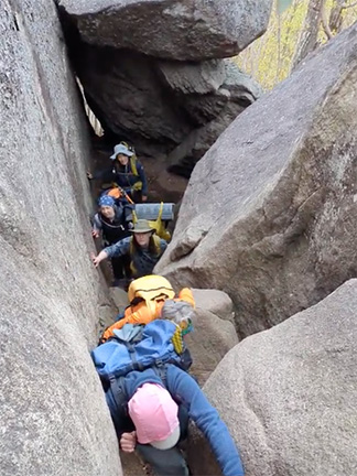
(Don’t forget to turn your clocks ahead.) From bus stop on Rte. 9W, at approach to Bear Mtn., hike the entire, reopened, Cornell Mine Trail. Turn left onto Ramapo-Dunderberg Trail, which use until it meets the Timp-Torne Trail near Rte. 9W. Use TT back to RD, RD over The Timp and Cats Elbow, then follow new Orange Trail to join Suffern-Bear-Mountain Trail, and return to TT. Use TT to meet Appalachian Trail, which hike to the 1777W Trail. Use 1777W to SBM. Exit to Bear Mountain Inn and bus stop via SBM. NY-NJTC map 119.
• UPDATE 03/03/2026: Due to residual winter conditions, hike will be shortened from original route (described above). Leader will decide on route changes on the day of the hike depending on trail conditions, weather and group size. There are 3 options: 11.8, 9.3 and 8.9 miles. Nothing less than 8.9 miles.
• Microspikes strongly advised
• Strenuous
• Duration about 7-8 hours at a fast pace
Accessible by bus–contact leader for details.
Leader: Erik

SUFFERN LOOP.
(Harriman State Park)
From Suffern train station use Suffern-Bear Mountain Trail for three miles, then turn right onto unnamed woods road (below power line); then turn left onto gas pipeline access road, which hike all the way to Pine Meadow Trail and Reeves Meadow Visitor Center. Next, hike south on Reeves Brook Trail to an unnamed woods road connecting to Seven Hills Trail; then right on Hillburn-Torne-Sebago Trail, right on Raccoon Brook Hills Trail, and connect with Torne Valley Road (TVR) via the gas pipeline access road. Use TVR for exit to Suffern. NY-NJTC map 118.
• Strenuous
• Duration about 7-8 hours at a brisk pace
Accessible by train–contact leader for details.
Leaders: Hugues; Annette

RINGWOOD SCULPTURE PARK.
(New Jersey)
From #197 NJT bus stop at Margaret King Avenue enter and hike Monks Mountain Loop. Retrace to bus stop and continue to, and cross, Monksville Dam. Join Stonetown Circular southbound and hike to Highlands Spur, leading to the Ringwood Sculpture Park’s Loop Trail. Then, use White and Stonetown roads to return to SC, which hike to join Highlands Trail. Use HT northbound to Hewitt bus stop for return by #197 bus to NYC. (Leader may use Burnt Meadow Trail, or other trails, to lengthen the hike.) NY-NJTC map 151.
• Strenuous
• Duration about 7-8 hours at a fast pace
Accessible by bus–contact leader for details.
Leader: Turi

BEACON TO COLD SPRING VIA FISHKILL RIDGE LOOP.
(East Hudson Highlands)
(Note: this is a Saturday hike.) From Beacon train station take local streets to the woods road off Mountain Lane (near the Fishkill Ridge Trail) and meet short Blue trail to bypass Dozer junction and join Fishkill Ridge Trail. Use FRT over Lambs Hill to join another woods road passing Beacon Reservoir. Brief left on Casino Trail and right on Wilkinson Trail leading to Breakneck Ridge, Cornish, Washburn, Nelsonville, and Undercliff trails for exit to Cold Spring.
• Strenuous
• Duration about 7-8 hours at a fast pace
Accessible by train–contact leader for details.
Leader: Todd

No Sunday Hike.
>> April
OLD ROADS: ORRS MILL TO HIGHLAND FALLS.
(West Hudson Highlands)
From bus stop use Mill Street to pick up right-of-way of former NYOW railroad, proceeding to Rte. 9W; then through various school fields to downtown Cornwall. Use Continental Road into Black Road Forest, climbing to Two Gates. Follow Stillman Trail over Black Rock then Scenic Trail over Hill of Pines to Carpenter Road, which follow left to Go-Down Road. Circle Glycerine Hollow on the west loop of Carpenter Road then Old West Point Road down to Rte. 218. Use routes paralleling Highland Brook to Main Street, Highland Falls. Old roads may be overgrown and/or badly eroded with tricky footing; see them now before they disappear! NY-NJTC map 113.
• Duration about 7-8 hours at a brisk pace
Accessible by bus–contact leader for details.
Leader: Chris

WATCHUNG GEOLOGY AND HISTORY HIKE: A CIRCULAR.
(New Jersey)
From Summit station use local streets to Baltusrol Road/Summit Road entrance of Watchung Reservation. By various trails, visit the Trailside Nature and Science Center, geology and history trails, and hike other trails for a roughly clockwise tour of the reservation.
• Duration about 7-8 hours at a brisk pace
Accessible by train–contact leader for details.
Leader: Ingrid

HASENCLEVER IRON TRAIL.
(Ramapos)
From Margaret King Avenue bus stop hike to Monks Connector, thence on Hasenclever Iron Trail to its end near Ringwood Manor. Continue on Ringwood-Ramapo Trail to shore of Shepherd Lake. Join Shepherd Lake Trail and use one of three woods roads passing Potake Pond (leader’s choice), emerging on Sterling Mine Road with exit to Sloatsburg. NY-NJTC maps 150, 151.
• Strenuous
• Duration about 7-8 hours at a fast pace
Accessible by bus–contact leader for details.
Leader: Erik
THE STONE LIVING ROOM.
(New Jersey)
Norvin Green State Forest. From Haskell bus stop use Doty Road to join Posts Brook Trail leading to Lower Trail and Hewitt-Butler Trail (here, aka Highlands Trail). At Otter Hole, left on HB, meet and hike entire (short) Torne Trail, rejoin HB over Osio Rock, cross TT, and view the Stone Living Room. Continue on HB and return to Otter Hole. Rejoin HT, which hike to Echo Lake. Continue on HT clockwise around lake as far as woods road on west side. Use woods roads to exit at Kanouse Park and Ride and bus to Manhattan. NY-NJTC maps 125, 151.
• Strenuous
• Duration about 7-8 hours at a brisk pace
Accessible by bus–contact leader for details.
Leader: Maria

>> May
OSSINING CIRCULAR: TO CROTON DAM AND TEATOWN LAKE.
(Westchester)
Up to the dam on Old Croton Aqueduct; down to Ossining on Peekskill-Briarcliff Trail. Hike will include circling Teatown Lake. Use local streets to and from trail heads. NY-NJTC map 132.
• Duration about 7-8 hours at a moderate pace
Accessible by train–contact leader for details.
Leader: Michelle

POPOLOPEN TORNE.
(Originally planned for
Bear Mountain State Park)
From Manitou station cross Bear Mountain Bridge, use Blue Trail at right to Fort Montgomery. Then, via the 77/79 Trail, pass through the fort area before turning right onto Blauvelt Drive, then left onto Firefighter Memorial Drive. Meet Brooks Lake’s Red Trail, which hike clockwise. Via Mine Road, join Timp-Torne Trail and hike clockwise up and around Popolopen Torne. Return to Bear Mountain Bridge via local roads and BT, cross, and ascend Anthony’s Nose via the old, rugged, steep, navy blue blazed trail. Use Appalachian Trail and local roads to return to Manitou Station. (Note: route may change pending opening of North Harriman trails.) NY-NJTC maps 101, 119.
• Strenuous
• Duration about 7-8 hours at a fast pace
Accessible by train–contact leader for details.
Leader: Todd
67th SEMI-ANNUAL SUPERHIKE: TARRYTOWN TO GEORGE WASHINGTON BRIDGE INCLUDING THE PIERMONT RIVERWALK LOOP.
(Palisades Interstate Park)
(Note this is a Saturday hike.) From Tarrytown station cross the Mario Cuomo Bridge. Hike south to Piermont on the Old Erie Path Rail Trail, then do the Piermont Riverwalk Loop. (Here’s your chance to stand in the middle of the Hudson River and not get wet.) Join the Long Path, and follow it south to the George Washington Bridge. (Cross the bridge for NYC subway.)
• Semi-annual SuperHike
• Strenuous
• Duration about 8-10 hours at a fast pace
• Headlamps advised
Accessible by train–contact leader for details.
Leader: Todd
No Sunday Hike.
SPRING DAY OF GIVING BACK.
(Harriman State Park)
Trail maintenance Part 2. Volunteers remove blowdowns and trim overgrown vegetation on the Nurian Trail in Harriman State Park as part of our commitment to the trail community. Bring gloves, clippers, and garden tools if you have them. After finishing, possible hike out to Tuxedo. Additional cars are welcome. (Available drivers please contact leader in advance.) Thank you for pitching in. NY-NJTC Map 119.
• Duration about 7-8 hours at a brisk pace
Accessible by bus–contact leader for details.
Leader: Trails Committee Chair, Peter

ANOTHER DAY ON THE LONG PATH.
(Palisades Interstate Park)
(Note this is a Saturday hike.) From Closter Dock Road bus stop pass under Palisades Interstate Parkway to meet the Long Path. Then hike the LP north all day, passing Women’s Federation Monument and High Gutter Point; traversing Tallman Mountain State Park; entering Piermont; and hiking through Rockland Cemetery, Nike Overlook Park, Tackamack Town Park, and Blauvelt State Park. End on Waldron Avenue at Rte. 59 (Nyack) and the bus stop for Hudson Link H07 bus to Tarrytown train station. NY-NJTC maps 108, 109.
• Duration about 7-8 hours at a moderate pace
Accessible by bus–contact leader for details.
Leaders: Zee; Lilian


No Sunday hike
>> June
ADVANCE NOTICE: COWANS GAP STATE PARK.
(Pennsylvania)
Up to three days hiking in south central Pennsylvania, focusing on the Standing Stone Trail. Overnights in rustic cabin. Limited availability. Contact leader in advance for details.
Leader: Ian

* * *
Because in the end, you won’t remember the time you spent working in the office or mowing your lawn. Climb that goddamn mountain.
~Jack Kerouac
* * *
Member of New York-New Jersey Trail Conference
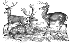
Top photo by Andres